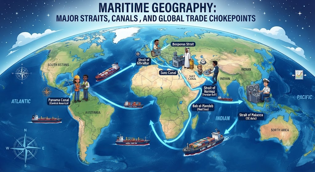
Over 80 percent of the world’s commercial merchandise by volume and more than 70 percent by value travels across the global ocean. While the high seas appear vast and unconstrained, maritime commerce is fundamentally channeled through narrow, geographically constrained corridors known as chokepoints. These critical natural straits and engineered artificial canals represent the jugular veins of international trade, energy security, and naval power projection. Any physical obstruction, geopolitical crisis, regional piracy wave, or military blockade across a single chokepoint can instantaneously destabilize global supply chains, spike hydrocarbon commodity prices, and disrupt continental industrial production.
The Geopolitics of Maritime Chokepoints
In strategic geography, maritime chokepoints derive their significance from the principle of least-distance navigation. Bypassing a closed strait or canal typically requires ships to detour thousands of nautical miles around continental capes—such as South Africa’s Cape of Good Hope or South America’s Cape Horn—adding weeks to transit schedules, consuming colossal quantities of bunker fuel, and inflating maritime freight insurance premiums.
Under the United Nations Convention on the Law of the Sea (UNCLOS), straits used for international navigation enjoy a special legal regime known as “transit passage.” Unlike innocent passage through territorial waters, transit passage permits continuous and expeditious navigation of commercial ships, foreign warships, and submarines in normal operating mode, which littoral states cannot legally suspend in peacetime.
| Chokepoint | Type | Waterways Connected | Daily Oil Flow / Trade Share | Bordering / Controlling States |
|---|---|---|---|---|
| Strait of Malacca | Natural Strait | Indian Ocean & South China Sea | ~16 million barrels/day (~25% of global trade) | Indonesia, Malaysia, Singapore |
| Strait of Hormuz | Natural Strait | Persian Gulf & Gulf of Oman | ~21 million barrels/day (~20% of global petroleum) | Iran, Oman, UAE |
| Suez Canal | Artificial Canal | Mediterranean Sea & Red Sea | ~12% of global trade; ~19,000 ships/year | Egypt |
| Bab-el-Mandeb | Natural Strait | Red Sea & Gulf of Aden | ~6 million barrels/day; gateway to Suez | Yemen, Djibouti, Eritrea |
| Panama Canal | Artificial Canal (Locks) | Atlantic Ocean & Pacific Ocean | ~5% of global maritime commerce; ~14,000 transits | Panama |
| Turkish Straits (Bosporus) | Natural Strait | Black Sea & Sea of Marmara | ~3 million barrels/day; grain corridor | Turkey |
The Top Maritime Chokepoints Analyzed
1. The Strait of Malacca: The Asian Energy Artery
Funneling between the Indonesian island of Sumatra and the Malay Peninsula, the Strait of Malacca spans approximately 800 kilometers (500 miles). At its narrowest point—the Phillips Channel in the Singapore Strait—the navigable shipping fairway constricts to barely 2.8 kilometers (1.5 nautical miles) in width. This creates a severe navigation bottleneck accommodating over 85,000 commercial vessels annually.
Malacca is the primary maritime pipeline fueling the manufacturing engines of East Asia. More than 80% of China’s crude oil imports, alongside vital shipments destined for Japan and South Korea, pass through this narrow trench. The strategic vulnerability of this bottleneck gave rise to former Chinese President Hu Jintao’s famous concept of the “Malacca Dilemma”—the fear that a hostile naval blockade in the strait could strangle the Chinese economy within weeks.
2. The Strait of Hormuz: The World’s Hydrocarbon Nexus
Situated between the Sultanate of Oman and the Islamic Republic of Iran, the Strait of Hormuz connects the hydrocarbon-rich Persian Gulf with the Arabian Sea. Despite spanning 39 kilometers at its narrowest point, the shipping channel consists of two two-mile-wide navigation lanes separated by a two-mile buffer zone.
Hormuz is the world’s most critical energy chokepoint. Approximately 21 million barrels of crude oil and petroleum products pass through the strait daily, representing roughly 20% of total worldwide liquid petroleum consumption. Furthermore, the world’s largest liquefied natural gas (LNG) exporter, Qatar, transports nearly all of its LNG exports through Hormuz. Because the northern littoral is controlled entirely by Iran, the strait has served as a chronic theater of geopolitical confrontation, tanker interdictions, and naval mine threats.
3. The Suez Canal and the Bab-el-Mandeb Gate
Engineered by French diplomat Ferdinand de Lesseps and opened in 1869, the 193-kilometer Suez Canal slices across the Isthmus of Suez in Egypt, providing a sea-level shortcut connecting the Mediterranean Sea with the Red Sea. Eliminating the perilous 9,000-kilometer circumnavigation around the southern tip of Africa, Suez saves cargo vessels approximately 10 to 14 days of sailing time between European manufacturing hubs and Asian ports.
However, transit through Suez is irrevocably tied to the Bab-el-Mandeb Strait (“Gate of Tears”) at the southern entrance of the Red Sea between Yemen on the Arabian Peninsula and Djibouti and Eritrea in the Horn of Africa. Recent military crises, missile strikes, and maritime drone attacks in the Red Sea have demonstrated how disruption at Bab-el-Mandeb cascades immediately into Suez, compelling major shipping alliances (such as Maersk and MSC) to divert hundreds of container ships around the Cape of Good Hope, inflating freight rates worldwide.
The Panama Canal: The Fresh Water Engineering Challenge
Slicing across the narrow Isthmus of Panama, the 82-kilometer Panama Canal connects the Atlantic and Pacific oceans. Unlike the sea-level Suez Canal, Panama is a lock-based canal system that lifts ships 26 meters (85 feet) above sea level over the continental divide using water sourced from artificial Lake Gatun, before lowering them back to ocean level on the opposite side.
The Panama Canal’s primary geographic limitation is not width, but hydrology. Every ship transit consumes approximately 52 million gallons of fresh water from Lake Gatun, which is dumped into the sea during lock cycles. In recent years, severe climate-induced droughts in Central America have depleted Lake Gatun’s reservoir levels, forcing the Panama Canal Authority to drastically curtail daily vessel transits from 36 down to 24 or fewer ships, triggering massive queues and rerouting agricultural grain carriers and container shipments.
Frequently Asked Questions About Maritime Geography
What is the legal status of the Turkish Straits?
The Bosporus and Dardanelles straits are governed by the 1936 Montreux Convention. The treaty guarantees freedom of transit for civilian merchant vessels in both peacetime and wartime. However, it grants Turkey the authority to close the straits to warships of belligerent states during armed conflicts, as Turkey invoked during the 2022 Russia-Ukraine war.
What is the Kra Isthmus Canal proposal?
The Kra Canal (or Thai Canal) is a long-proposed mega-project to cut a shipping channel across the narrow Kra Isthmus in southern Thailand. The canal would allow ships to bypass the congested Strait of Malacca, shaving roughly 1,200 kilometers off trade routes between India and East Asia, though high financial costs, environmental impacts, and internal security concerns have stalled its execution.
What is the difference between innocent passage and transit passage?
Under international maritime law, innocent passage applies to sovereign territorial waters and requires foreign vessels to navigate non-prejudicially to coastal state security (submarines must surface, military radars and maneuvers are restricted). In contrast, transit passage applies to international straits, allowing continuous, unimpeded navigation where warships and submarines may transit submerged and in normal military configuration.