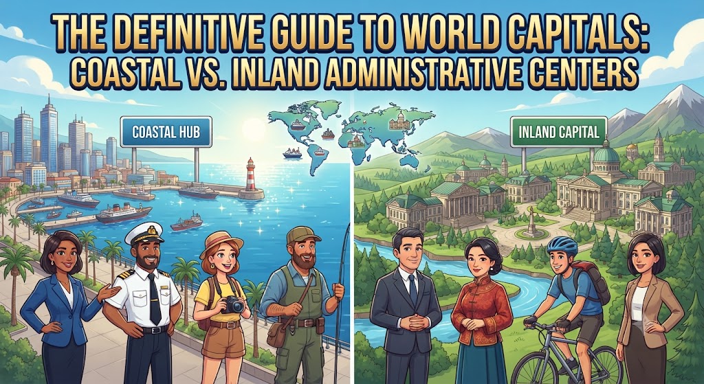
National capital cities stand as the political, administrative, and symbolic epicenters of sovereign nations. Across the globe, the geographical positioning of a capital city is rarely an accident of history. Rather, it represents a calculated intersection of geopolitical defense, commercial viability, ethnic compromise, and territorial integration. One of the most fascinating spatial divisions in human geography is the distinction between coastal capital cities—nations anchored to global maritime lanes—and inland capital cities—often engineered or retained deep within the continental interior to foster national cohesion or provide defensive sanctuary.
The Geopolitical Philosophy of Capital Placement
Throughout ancient and modern history, state planners have wrestled with a fundamental dilemma: should the seat of government be situated on the periphery to interface with global trade, or should it be insulated within the heartland to govern all territories equitably? Coastal capitals offer immediate accessibility to global maritime corridors, facilitating rapid international diplomacy, naval dominance, and mercantile expansion. However, maritime exposure historically left seats of authority vulnerable to naval bombardments, foreign blockades, and amphibious invasions.
Conversely, inland capitals are traditionally chosen for their strategic defensibility and internal balance. By placing the administrative center in the interior, governments can project sovereign power outward toward restive frontier zones. In federal systems comprised of competing linguistic or ethnic provinces, establishing a neutral inland capital frequently prevents historic commercial ports from monopolizing the political destiny of the wider federation.
| Capital City | Country | Position Type | Establishment / Transfer Year | Strategic Rationale |
|---|---|---|---|---|
| Brasília | Brazil | Inland (Engineered) | 1960 | Interior regional development; neutral administrative hub away from Rio de Janeiro. |
| Canberra | Australia | Inland (Engineered) | 1913 | Compromise settlement between rival commercial giants Sydney and Melbourne. |
| Washington, D.C. | United States | Estuarine / Coastal Plain | 1790 | Compromise between northern and southern states along the Potomac River. |
| Abuja | Nigeria | Central Inland | 1991 | Ethnic and religious neutrality; relieving severe congestion from coastal Lagos. |
| Tokyo | Japan | Coastal (Tokyo Bay) | 1868 | Imperial consolidation in the mercantile core of the Kanto Plain. |
| Naypyidaw | Myanmar | Inland (Engineered) | 2005 | Central security stronghold; strategic detachment from vulnerable coastal Yangon. |
Coastal Capitals: Gateways to Global Commerce and Empire
Maritime capitals are the hallmark of trading nations, archipelago states, and former colonial headquarters. Cities such as London on the tidal Thames, Tokyo on Tokyo Bay, Buenos Aires on the Rio de la Plata, and Manila on Manila Bay were built to capture the flow of international shipping. For archipelagos like the Philippines, Indonesia, and the United Kingdom, coastal or near-coastal placement was essential for coordinating maritime defense and overseas dependencies.
Economic Advantages of Maritime Seats of Power
The primary economic asset of a coastal capital is its frictionless integration with world logistics networks. Deepwater harbor access allows political leaders to directly supervise customs, maritime tariffs, and major commercial exchanges. In nations where the capital also functions as the primary financial center (such as London, Tokyo, or Copenhagen), the concentration of corporate headquarters, foreign embassies, and logistics infrastructure produces massive agglomeration economies.
Furthermore, coastal capitals attract human capital and foreign direct investment at significantly higher rates than interior settlements. The cosmopolitan nature of coastal ports frequently makes them incubators of cultural exchange, diplomatic relations, and technological innovation. In developing economies, prioritizing the maritime gateway enabled rapid industrial development fueled by export-oriented manufacturing.
Vulnerabilities: Sea-Level Rise and Climate Exposure
Despite their commercial supremacy, coastal capitals face unprecedented existential risks in the twenty-first century. Accelerated sea-level rise, intensified typhoons, storm surges, and coastal subsidence present monumental engineering challenges. Jakarta, the longstanding coastal capital of Indonesia on the northwest coast of Java, represents the premier modern crisis of maritime capital geography.
Severe ground subsidence caused by excessive groundwater extraction, combined with tidal surges from the Java Sea, has resulted in northern sections of Jakarta sinking by up to 25 centimeters annually. This impending environmental crisis compelled the Indonesian parliament to legislate the creation of Nusantara, a brand-new master-planned capital situated hundreds of kilometers away in the interior forests of East Kalimantan on the island of Borneo.
Inland Relocations: Planned Capitals and Territorial Integration
The deliberate relocation of a national capital from a congested coastal metropolis to an engineered interior site is one of the most ambitious undertakings a sovereign government can execute. These “forward capitals” or compromise capitals are explicitly designed to restructure national demographic patterns and project economic development into underpopulated interior territories.
Brasília: Conquering the Brazilian Hinterland
Until the mid-twentieth century, Brazil’s population and economic vitality were overwhelmingly concentrated in a narrow coastal strip surrounding Salvador and later Rio de Janeiro. In 1956, President Juscelino Kubitschek launched the construction of Brasília in the high central plateau (Planalto Central). Designed by urban planner Lúcio Costa and architect Oscar Niemeyer in the shape of a massive airplane, Brasília was formally inaugurated in 1960.
The geographic objective was profound: shift the psychological and infrastructural center of gravity away from the Atlantic seaboard toward the vast interior Cerrado and the Amazon basin. Roads, power grids, and agricultural settlements followed the capital, fundamentally transforming central Brazil into one of the world’s most productive grain and soybean frontiers, while shielding the central government from coastal naval threats.
Abuja: Resolving Ethnic and Demographic Gridlock in Nigeria
Following independence, Nigeria governed from the bustling maritime metropolis of Lagos on the Gulf of Guinea. However, Lagos was plagued by legendary traffic congestion (“go-slows”), chronic land shortages, and deep ethnic associations with the Yoruba southwest. In 1976, the Nigerian government designated Abuja, situated in the geographic center of the country within a neutral Federal Capital Territory, as the new capital.
Abuja sits at the crossroads between the predominantly Muslim Hausa-Fulani north, the Christian Igbo southeast, and the Yoruba southwest. By establishing an inland capital free from the historical hegemony of any single ethnic or religious faction, Nigeria established a powerful civic symbol of national unity while dispersing administrative development into the Middle Belt region.
Compromise Capitals: Neutralizing Regional Rivalries
In diverse federations where two or more dominant urban centers command equal commercial, cultural, and political weight, selecting an existing city as the national capital inevitably sparks bitter sectional resentment. To preserve federal harmony, nations have repeatedly constructed brand-new inland capitals equidistant from rival poles.
Canberra: Resolving the Sydney-Melbourne Feud
When the six Australian colonies federated into the Commonwealth of Australia in 1901, intense rivalry between Sydney (in New South Wales) and Melbourne (in Victoria) threatened the constitutional settlement. Neither city would tolerate the other serving as the permanent seat of power. The constitutional delegates resolved the stalemate by mandating that a new federal capital be constructed in New South Wales, but at least 100 miles (160 km) from Sydney, with Melbourne serving as the temporary seat of parliament.
In 1908, the inland site of Canberra was selected among the rolling hills of the Australian Capital Territory. American architect Walter Burley Griffin designed the city around formal geometric axes and artificial Lake Burley Griffin. Today, Canberra thrives as a garden city exclusively dedicated to governance, diplomacy, higher education, and national cultural institutions, completely insulated from commercial coastal congestion.
Ottawa: The Canadian Linguistic Compromise
In nineteenth-century British North America, tensions between anglophone Upper Canada (Ontario) and francophone Lower Canada (Quebec) made governance chaotic. The legislative assembly rotated nomadically between Quebec City, Toronto, Montreal, and Kingston. Each transfer stoked intense cultural and political grievances.
In 1857, Queen Victoria was invited to resolve the dispute. She selected Ottawa, then a modest lumber settlement known as Bytown, located on the Ottawa River directly straddling the border between Ontario and Quebec. In addition to its linguistic neutrality, Ottawa offered superior military security: positioned inland behind dense pine forests and navigable waterways, it was far less vulnerable to American cross-border gunboat raids than Toronto or Montreal following the War of 1812.
Comparative Analysis: Strategic Strengths of Capital Environments
When evaluating the long-term sustainability of capital placements, urban geographers examine five fundamental criteria: defensibility, transportation accessibility, natural disaster exposure, administrative insulation, and symbolic inclusiveness.
Coastal capitals inherently excel in international accessibility and commercial vibrancy. Envoys, trade delegations, and multinational bodies navigate coastal logistics seamlessly. Yet this intense commercial vigor frequently results in runaway real estate inflation, overcrowding, and civil distraction: the seat of governance must compete daily against the cacophony of container ports, commercial stock exchanges, and tourism sectors.
Inland administrative cities, while periodically criticized as sterile, bureaucratic company towns, provide dedicated spaces where the machinery of governance can operate without the spatial friction of massive maritime logistics. Furthermore, in an era of rapid climate disruption, interior locations elevated above sea level provide natural insulation against the existential oceanic threats that will reshape coastal cities throughout the twenty-first century.
Frequently Asked Questions About World Capitals
Which country has multiple capital cities?
South Africa is the most prominent nation with three distinct capital cities, dividing governmental branches across different cities: Pretoria serves as the executive/administrative capital, Cape Town functions as the legislative capital (seat of Parliament), and Bloemfontein acts as the judicial capital (seat of the Supreme Court of Appeal). Additionally, Bolivia recognizes Sucre as its constitutional capital, while La Paz serves as the seat of the executive and legislative branches.
What is the highest capital city in the world?
La Paz, Bolivia, is the highest de facto national capital in the world, sitting at an average elevation of approximately 3,640 meters (11,942 feet) above sea level in the Andes mountains. If considering constitutional capitals, Sucre, Bolivia, sits at 2,810 meters (9,219 feet), while Quito, Ecuador, is the highest official capital city at 2,850 meters (9,350 feet).
Why do countries continue to build planned inland capitals?
Governments continue to engineer planned inland capitals to alleviate catastrophic urban overcrowding in legacy coastal hubs, distribute regional wealth into neglected interior provinces, provide neutral territory in ethnically diverse nations, and insulate critical government infrastructure from maritime storms, flooding, and rising sea levels.