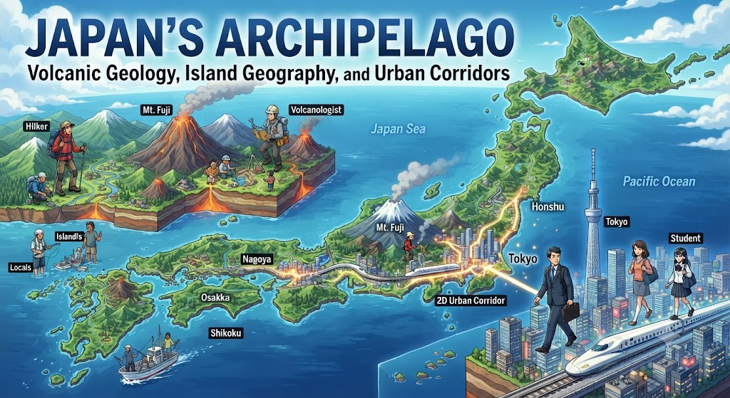
Stretching in a sweeping crescent along the eastern rim of the Asian landmass, the Japanese archipelago (Nihon Rettō) represents one of the world’s most physically dynamic, geologically volatile, and densely engineered nations. Comprising 6,852 islands extending over 3,000 kilometers from the subarctic waters of the Sea of Okhotsk to the subtropical reaches of the East China Sea, Japan covers 377,975 square kilometers. Despite having a land area smaller than the US state of California, Japan supports over 124 million people, over 70% of whom are concentrated in narrow, hyper-developed coastal plains.
Tectonic Crucible: The Pacific Ring of Fire
Japan’s physical geography is defined by its precarious position atop the collision zone of four major tectonic plates: the Pacific Plate, the North American Plate (Okhotsk Plate), the Eurasian Plate (Amur Plate), and the Philippine Sea Plate. This complex tectonic junction places Japan directly within the Pacific “Ring of Fire,” rendering it one of the most seismically and volcanically active regions on Earth.
Subduction processes dominate the archipelago: the oceanic Pacific Plate subducts beneath the continental Okhotsk Plate along the Japan Trench in the northeast at a rate of 8 to 9 centimeters annually, while the Philippine Sea Plate subducts beneath the Eurasian Plate along the Nankai Trough in the southwest. These subduction zones generate over 1,500 detectable earthquakes every year and give rise to 111 active volcanoes—accounting for approximately 10% of all active volcanoes on Earth.
| Main Island | Land Area (km²) | Approx. % of Land | Topographical & Climatic Character | Primary Urban Centers |
|---|---|---|---|---|
| Honshu | 227,960 | 60.3% | Mountainous spine (Japanese Alps), extensive plains (Kanto, Nobi), temperate. | Tokyo, Yokohama, Osaka, Kyoto, Nagoya, Hiroshima |
| Hokkaido | 83,424 | 22.1% | Volcanic plateaus, wide agricultural basins, subarctic, heavy winter snow. | Sapporo, Asahikawa, Hakodate |
| Kyushu | 36,782 | 9.7% | Highly volcanic (Mt. Aso, Sakurajima), subtropical, thermal springs. | Fukuoka, Kitakyushu, Kumamoto, Kagoshima |
| Shikoku | 18,297 | 4.8% | Rugged mountainous interior, Seto Inland Sea coastline, Mediterranean-like. | Matsuyama, Takamatsu, Kochi, Tokushima |
| Okinawa & Ryukyu | 2,281 | 0.6% | Coral limestone atolls, subtropical rainforests, typhoon exposure. | Naha |
Topographical Constraints: Mountains and Coastal Lowlands
More than 73% of Japan’s total land area consists of rugged, forest-clad mountains and volcanic ranges. The central spine of Honshu is dominated by the soaring Japanese Alps, comprising the Hida (Northern), Kiso (Central), and Akaishi (Southern) ranges, many peaks of which exceed 3,000 meters in elevation. Mount Fuji (Fuji-san), an iconic active stratovolcano rising symmetrically to 3,776 meters (12,389 feet), stands as the nation’s highest peak and sacred cultural symbol.
Because mountainous terrain is generally unsuitable for intensive agriculture, heavy manufacturing, or residential subdivisions, human settlement has been forced into isolated alluvial basins and narrow coastal plains formed by swift, short rivers. The largest of these is the Kanto Plain on eastern Honshu, spanning approximately 17,000 square kilometers, followed by the Kansai (Osaka) Plain and the Nobi (Nagoya) Plain.
The Tokaido Megalopolis: World’s Densest Urban Axis
The concentration of population on these contiguous lowland plains has produced the Tokaido megalopolis, a colossal urban-industrial corridor stretching along Honshu’s Pacific coastline from Tokyo through Nagoya to Osaka and Kobe. This corridor accommodates more than 75 million people—nearly 60% of Japan’s total population—connected seamlessly by high-speed Shinkansen bullet trains and deepwater port complexes.
The Greater Tokyo Area alone, encompassing Tokyo Metropolis and the surrounding prefectures of Kanagawa, Saitama, and Chiba, contains over 37 million residents, constituting the most populous metropolitan agglomeration on Earth. To overcome acute spatial limitations, Japanese civil engineers have reclaimed hundreds of square kilometers of coastal land from Tokyo Bay and Osaka Bay, constructing artificial islands for international airports (such as Haneda and Kansai) and container terminals.
Hydrology and Natural Hazards: Engineering Resilience
Due to the narrow width of the Japanese islands and the extreme gradient from alpine summits to sea level, Japan’s rivers are characteristically short, steep, and torrential. Notable waterways like the Shinano River (Japan’s longest at 367 km) and the Tone River (possessing the largest drainage basin) resemble rushing mountain torrents rather than meandering continental rivers.
During summer typhoons and intense autumn rainfalls, these rivers are prone to rapid flash flooding and violent debris flows (dosha-kuzure). To mitigate these catastrophic hazards, Japan has pioneered the world’s most advanced disaster prevention infrastructure. Beneath the northern outskirts of Tokyo lies the Metropolitan Inter-Basin Flood Mitigation Channel (G-CANS), a colossal subterranean floodwater diversion system featuring massive underground silos and cathedral-like water tanks capable of pumping 200 cubic meters of floodwater per second directly into the Edo River.
The Four Main Islands: Regional Character
Honshu: The main island, home to Japan’s primary historic and modern capitals (Kyoto, Nara, and Tokyo), the core industrial belt, and major agricultural production in the Tohoku region.
Hokkaido: The northern frontier, developed in the late 19th century. Marked by a distinct grid-like urban layout in Sapporo, extensive dairy farming, expansive national parks, and indigenous Ainu cultural history.
Kyushu: The southwestern volcanic powerhouse, serving historically as Japan’s primary maritime gateway to mainland Asia. Known for semiconductor manufacturing (“Silicon Island”), rich geothermal resources, and active calderas like Mount Aso.
Shikoku: The smallest and least populated of the four main islands, celebrated for its 88-temple Buddhist pilgrimage route, citrus agriculture, and stunning coastal scenery along the tranquil Seto Inland Sea.
Frequently Asked Questions About Japan’s Geography
What caused the catastrophic 2011 Tohoku earthquake and tsunami?
On March 11, 2011, a monumental magnitude 9.0–9.1 megathrust earthquake occurred along the subduction zone of the Japan Trench, approximately 70 kilometers east of the Oshika Peninsula. The rupture displaced the seabed by tens of meters vertically, triggering massive tsunami waves exceeding 40 meters in run-up height that devastated coastal communities across Iwate, Miyagi, and Fukushima prefectures.
Why does Japan have so many hot springs (onsen)?
Japan’s ubiquitous hot springs are the direct result of intense widespread volcanism. Magma chambers located relatively close to the Earth’s crust heat deep subterranean groundwater reservoirs, which percolate to the surface enriched with minerals like sulfur, iron, and sodium chloride, sustaining over 3,000 hot spring resort towns across the archipelago.
What is the Seikan Tunnel?
The Seikan Tunnel is a 53.85-kilometer (33.46-mile) dual-gauge railway tunnel passing beneath the stormy Tsugaru Strait, physically linking the main island of Honshu with the northern island of Hokkaido. With a 23.3 km undersea section sitting 100 meters below the seabed, it was the world’s longest undersea tunnel by total track length until the opening of the Gotthard Base Tunnel.