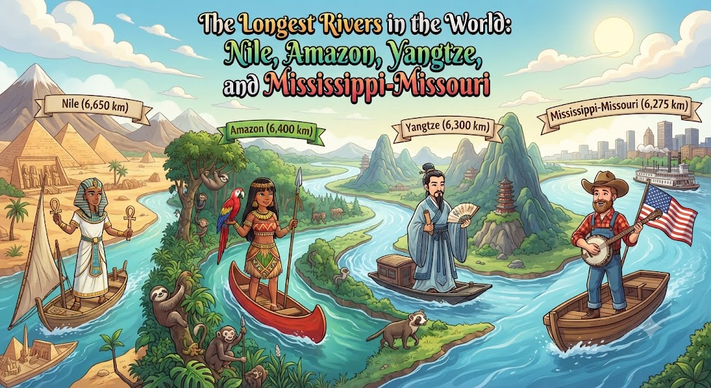
Rivers are the primary sculptors of continental landforms and the indispensable cradles of human civilization. Throughout human history, cities, agriculture, trade, and empires have coalesced along major river corridors. Across the globe, continental river networks drain billions of tons of fresh water and mineral-rich sediment into the oceans, sustaining critical riparian ecosystems and human populations. Yet determining the definitive hierarchy of the world’s longest rivers involves complex hydrological measurements, seasonal debates over true river sources, and satellite mapping technology.
The Measurement Challenge: Defining a River’s Source and Mouth
Establishing the exact linear length of a continental river is one of the most notoriously contentious endeavors in cartography. To measure a river accurately, hydrologists must resolve three fundamental problems:
Locating the True Source: A river system consists of thousands of branching headwater streams. Hydrologists define the true source as the headwater tributary whose origin point is the greatest distance from the river mouth along the continuous flow of water. However, seasonal snowmelt, shifting glacial tarns, and braided wetlands frequently obscure the precise starting point.
Measuring Meanders: Continental lowland rivers do not flow in straight lines; they curve, loop, and meander through thousands of kilometers of oxbow bends. High-resolution satellite imagery measures every micro-curve, yielding substantially longer distances than historical low-resolution topographic surveys.
Defining the Mouth in Vast Deltas: In massive river systems like the Amazon or Ganges-Brahmaputra, the river mouth expands into an intricate labyrinth of tidal channels, barrier islands, and estuaries spanning hundreds of kilometers, making the exact boundary between river channel and open ocean difficult to define.
| River System | Official Length (km / mi) | Drainage Basin (km²) | Average Discharge (m³/s) | Continents / Countries Traversed |
|---|---|---|---|---|
| Nile System | 6,650 km / 4,132 mi | 3,254,555 km² | 2,800 m³/s | Africa (11 countries including Egypt, Sudan, Ethiopia, Uganda) |
| Amazon System | 6,400–6,992 km / 3,977–4,345 mi | 7,050,000 km² | 209,000 m³/s | South America (Brazil, Peru, Colombia, Bolivia, Ecuador) |
| Yangtze (Chang Jiang) | 6,300 km / 3,915 mi | 1,800,000 km² | 30,166 m³/s | Asia (China exclusively) |
| Mississippi-Missouri | 6,275 km / 3,902 mi | 3,220,000 km² | 16,792 m³/s | North America (United States, Canada) |
| Yenisey-Angara | 5,539 km / 3,442 mi | 2,580,000 km² | 19,800 m³/s | Asia (Russia, Mongolia) |
| Yellow River (Huang He) | 5,464 km / 3,395 mi | 752,000 km² | 2,571 m³/s | Asia (China exclusively) |
The Great Title Fight: The Nile vs. The Amazon
For over a century, standard encyclopedias have credited the Nile River as the longest river on Earth at approximately 6,650 kilometers (4,132 miles), with the Amazon River traditionally measured at approximately 6,400 kilometers (3,977 miles). However, this ranking has been vigorously challenged by Brazilian researchers and satellite geodesists.
The Case for the Nile: Africa’s Lifeline
The Nile flows northward through eastern and northeastern Africa into the Mediterranean Sea. It is formed by the confluence of two primary tributaries: the White Nile, which originates in the high-altitude streams of the Great Lakes region of Central Africa (flowing from Lake Victoria via the Kagera River), and the Blue Nile, which originates in Lake Tana in the Ethiopian Highlands.
While the White Nile is the longer branch, the Blue Nile supplies approximately 80% of the river’s water and the legendary fertile black silt that sustained dynastic Egyptian civilization for millennia. Traversing the hyper-arid Sahara Desert without receiving any major perennial tributary south of the Atbarah River, the Nile stands as a marvel of hydrological endurance.
The Case for the Amazon: Remote Glacial Headwaters
In recent decades, expeditions supported by the National Geographic Society and the Brazilian National Institute for Space Research (INPE) traced the furthest source of the Amazon to the snow-covered slopes of Nevado Mismi and Quebrada Apacheta in the southern Peruvian Andes. By measuring the river from this southern source through the Carhuasanta, Lloqueta, Apurímac, Ucayali, and Marañón rivers, and tracing the mouth through the southern tidal channel around Marajó Island into the Atlantic, researchers calculated a total length of 6,992 kilometers (4,345 miles)—which would make the Amazon longer than the Nile.
While the international hydrological community continues to verify these methodologies, there is no dispute regarding volume: the Amazon is by far the largest river on Earth, discharging more water than the Nile, Yangtze, and Mississippi combined.
The Mississippi-Missouri System: North America’s Arterial Spine
In North America, the Mississippi River proper begins at Lake Itasca in northern Minnesota and flows 3,766 kilometers south to the Gulf of Mexico. However, hydrologists consider the continuous stream from the headwaters of the Missouri River (rising in the Rocky Mountains of Montana) through its confluence near St. Louis and down the lower Mississippi as a single hydrological unit: the Mississippi-Missouri river system, spanning 6,275 kilometers (3,902 miles).
Draining all or parts of 32 US states and two Canadian provinces across an area of 3.22 million square kilometers (over 40% of the contiguous United States), this river basin represents the world’s most productive navigable inland waterway. It handles hundreds of millions of tons of agricultural grain, petroleum, and manufactured freight annually through an elaborate system of locks and dams maintained by the US Army Corps of Engineers.
Frequently Asked Questions About World Rivers
What is the deepest river in the world?
The Congo River in Central Africa is the deepest river in the world, with measured depths exceeding 220 meters (720 feet) in its lower gorges below Malebo Pool. Its powerful currents and steep underwater canyons have created unique evolutionary micro-habitats, isolating distinct blind fish species on opposite sides of the river.
Why is the Yellow River called “China’s Sorrow”?
The Yellow River (Huang He) carries the highest sediment concentration of any river on Earth, eroding billions of tons of yellow-colored loess silt from the Loess Plateau annually. Over centuries, silt accumulation elevated the riverbed above the surrounding North China Plain. Catastrophic dike failures historically caused monumental floods that altered the river’s mouth by hundreds of kilometers and claimed millions of lives, earning it the historic moniker “China’s Sorrow.”
Which river flows through the most sovereign countries?
The Danube River in Europe holds the world record for flowing through or forming the international border of the highest number of sovereign nations: ten countries in total (Germany, Austria, Slovakia, Hungary, Croatia, Serbia, Romania, Bulgaria, Moldova, and Ukraine).