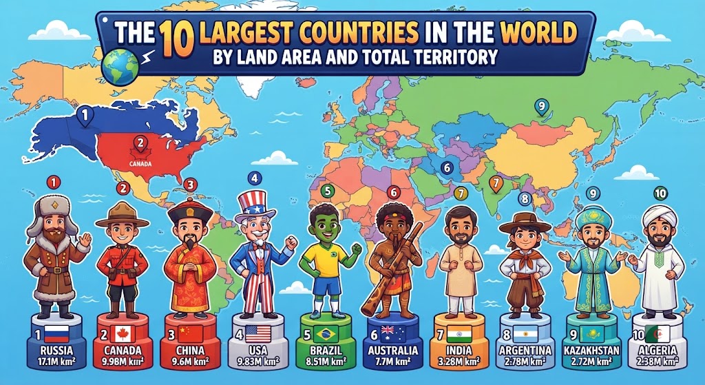
The total surface area of planet Earth spans approximately 510 million square kilometers, of which roughly 149 million square kilometers consists of dry land. Remarkably, nearly half of this terrestrial landmass is partitioned among just ten sovereign nations. These continental giants possess monumental ecological diversity, vast mineral and fossil fuel wealth, multi-biome frontiers, and complex geopolitical spheres of influence. However, measuring sovereign territory requires a crucial geographical distinction: total area (which encompasses internal lakes, rivers, and coastal inlets) versus strict terrestrial land area.
Total Area vs. Land Area: Understanding Cartographic Accounting
When geographers rank the world’s largest nations, rankings frequently shift depending on whether internal water bodies are included. For example, Canada possesses more natural freshwater lakes than the rest of the world combined, with inland water accounting for nearly 9% of its total territory. If comparing total territory (land plus internal water), Canada ranks second in the world. However, if comparing dry land area alone, both the United States and the People’s Republic of China surpass Canada in physical dry ground.
| Rank | Country | Total Area (km²) | Dry Land Area (km²) | % of Earth’s Land | Primary Biomes & Geography |
|---|---|---|---|---|---|
| 1 | Russia | 17,098,242 | 16,377,742 | 11.0% | Siberian taiga, tundra, Urals, steppe, permafrost. |
| 2 | Canada | 9,984,670 | 9,093,507 | 6.1% | Boreal forest, Arctic archipelago, Canadian Shield, prairies. |
| 3 | China | 9,596,961 | 9,326,410 | 6.3% | Tibetan plateau, Gobi desert, Yangtze basin, Manchurian plain. |
| 4 | United States | 9,525,067 | 9,147,593 | 6.1% | Great Plains, Rocky Mountains, Mississippi basin, Alaskan wilderness. |
| 5 | Brazil | 8,515,767 | 8,460,415 | 5.7% | Amazon rainforest, Cerrado savanna, Pantanal wetland, Caatinga. |
| 6 | Australia | 7,692,024 | 7,633,565 | 5.1% | Arid Outback, Great Dividing Range, tropical north, Great Barrier Reef. |
| 7 | India | 3,287,263 | 2,973,193 | 2.0% | Himalayan arc, Indo-Gangetic plain, Deccan plateau, Thar desert. |
| 8 | Argentina | 2,780,400 | 2,736,690 | 1.8% | Pampas grasslands, Andes mountains, Patagonian desert, Gran Chaco. |
| 9 | Kazakhstan | 2,724,900 | 2,699,700 | 1.8% | Central Asian steppe, Aral/Caspian basins, Tian Shan foothills. |
| 10 | Algeria | 2,381,741 | 2,381,741 | 1.6% | Sahara desert (over 80%), Atlas mountains, Mediterranean coast. |
Profiles of the Top Continental Giants
1. The Russian Federation: The Transcontinental Colossus
Spanning an astounding 17.1 million square kilometers across eleven time zones, Russia is by far the largest sovereign country on Earth, covering roughly one-eighth of the planet’s inhabited landmass. Stretching from the Baltic Sea in Europe to the Bering Strait bordering Alaska, Russia encompasses the northern half of the Eurasian continent.
Geologically, Russia is bifurcated by the Ural Mountains, which separate European Russia from Siberia. Over 60% of Russian territory is underlain by continuous or discontinuous permafrost, and it contains the world’s largest forest reserve—the Siberian taiga—which acts as a colossal global carbon sink. Lake Baikal in southern Siberia contains roughly 20% of the world’s unfrozen surface fresh water.
2. Canada: The Northern Freshwater Empire
Extending from the Atlantic to the Pacific and northward into the Arctic Ocean, Canada encompasses nearly 10 million square kilometers. However, due to the harsh subarctic climate and the thin, rocky soils of the ancient Canadian Shield, more than 80% of Canada’s 40 million residents live within 160 kilometers (100 miles) of the southern border with the United States.
Canada boasts the longest coastline in the world, stretching over 243,042 kilometers across thousands of islands in the Arctic Archipelago, including Baffin Island, Victoria Island, and Ellesmere Island. It holds approximately 7% of the planet’s renewable freshwater supply.
3. China: The Asian Geomorphological Staircase
Covering approximately 9.6 million square kilometers, the People’s Republic of China is the third-largest nation by total area and the largest country entirely within Asia. China’s topography resembles a gigantic three-step staircase descending from west to east:
The top step is the colossal Qinghai-Tibet Plateau (the “Roof of the World”), rising over 4,000 meters above sea level and bordered by the Himalayas. The middle step comprises arid desert plateaus and rolling basins (the Tarim Basin, Inner Mongolian Plateau, and Sichuan Basin) between 1,000 and 2,000 meters. The lowest step consists of the fertile, densely populated alluvial plains of the Yellow, Yangtze, and Pearl Rivers along the Pacific coastline, housing over 90% of China’s population.
Comparative Global Perspectives: Scale and Settlement
Possessing vast territorial land area does not automatically correlate with agricultural capacity or human habitability. For instance, while Australia encompasses 7.69 million square kilometers (an entire continent), roughly 70% of its landmass is classified as arid or semi-arid desert (“the Outback”), leaving the population heavily clustered in a narrow temperate coastal crescent in the southeast.
Conversely, India, ranking seventh with 3.28 million square kilometers, possesses a significantly higher proportion of arable land (over 52% of its total territory is cultivable, compared to under 10% in Russia or Canada). Consequently, India sustains a population of over 1.4 billion people—more than ten times the population of Russia—demonstrating that geographic carrying capacity is determined by climate, water availability, and soil fertility rather than raw land area alone.
Frequently Asked Questions About the Largest Countries
Why is Sudan no longer the largest country in Africa?
Until 2011, the Republic of the Sudan was the largest country in Africa, spanning over 2.5 million square kilometers. However, following a historic referendum, South Sudan seceded on July 9, 2011, partitioning the nation. As a result, Algeria became the largest country in both Africa and the Arab world, with a territory of 2.38 million square kilometers.
What is the smallest country in the world?
The State of the Vatican City is the smallest sovereign nation on Earth, covering an area of just 0.49 square kilometers (121 acres) completely surrounded by the city of Rome, Italy. Monaco ranks as the second-smallest at approximately 2.02 square kilometers.
How much of Russia is in Europe versus Asia?
Approximately 77% of Russia’s total land area lies east of the Ural Mountains in Asia (Siberia and the Russian Far East), while 23% lies in Europe. However, human demographics are inverted: roughly 75% of Russia’s population resides in European Russia, centered around Moscow and Saint Petersburg.