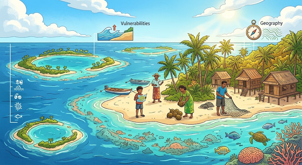
Scattered like celestial constellations across the vast expanses of the Indian and Pacific Oceans, Small Island Developing States (SIDS) represent the world’s most ecologically fragile, geographically isolated, and climate-vulnerable sovereign communities. From the low-lying coral atolls of Tuvalu and the Maldives to the rugged volcanic archipelagos of Vanuatu and Fiji, these nations command immense Exclusive Economic Zones (EEZs) that encompass tens of millions of square kilometers of ocean, yet their terrestrial footprint is perilously minimal. As twenty-first-century sea-level rise accelerates, island nations stand on the front lines of an existential struggle against ocean dynamics.
Geological Genesis: Volcanic Islands vs. Coral Atolls
To understand the geography and vulnerabilities of island nations, one must examine the geological evolutionary sequence first formulated by Charles Darwin in 1842 during his voyage aboard HMS Beagle:
1. Volcanic Island Stage: An undersea volcanic hotspot or tectonic subduction zone erupts basaltic lava from the oceanic floor, building upward until a high mountainous island breaches the surface (e.g., Hawaii, Samoa, Mauritius).
2. Fringing Reef to Barrier Reef: In warm, clear, sunlit tropical waters, calcium-carbonate-secreting coral polyps construct a fringing reef directly attached to the volcanic shoreline. As the extinct volcanic crust slowly cools, becomes denser, and subsides into the mantle, the coral continues growing upward toward sunlight, leaving a wide, sheltered lagoon between the sinking island and a barrier reef.
3. The Coral Atoll Stage: Eventually, the central volcanic mountain subsides entirely beneath the ocean surface. All that remains is a roughly circular ring of coral reefs, sand cays (motus), and storm-deposited limestone debris enclosing a central turquoise lagoon. The highest elevation on a true coral atoll rarely exceeds 2 to 3 meters (6 to 10 feet) above mean sea level.
| Island Nation | Ocean / Region | Geological Formation | Max Natural Elevation | Exclusive Economic Zone (EEZ) | Primary Environmental Threats |
|---|---|---|---|---|---|
| Maldives | Indian Ocean | Double chain of 26 natural coral atolls | 2.4 m / 7.9 ft | 923,322 km² | Ocean thermal coral bleaching, storm surge inundation, freshwater salinization. |
| Tuvalu | Central Pacific Ocean | 3 reef islands & 6 coral atolls | 4.6 m / 15.0 ft | 749,790 km² | King tides, coastal erosion, lack of potable groundwater. |
| Kiribati | Central Pacific Ocean | 33 atolls spanning 3 island groups | 3.0 m (excl. Banaba) | 3,441,810 km² | Extreme geographic fragmentation, inundation of causeways, coastal flooding. |
| Marshall Islands | Micronesia (Pacific) | 29 coral atolls & 5 low islands | 10.0 m (average <2 m) | 2,131,000 km² | Typhoons, saltwater intrusion into taro pits, nuclear legacy (Bikini Atoll). |
| Vanuatu | Melanesia (South Pacific) | High volcanic archipelago (83 islands) | 1,879 m (Tabwemasana) | 663,251 km² | Severe Category 5 cyclones, earthquakes, active volcanic ashfalls. |
Existential Vulnerabilities: The Physics of Sea-Level Rise
For low-lying atoll nations like Tuvalu, the Maldives, and Kiribati, climate change is not a theoretical future projection, but an immediate daily reality. The Intergovernmental Panel on Climate Change (IPCC) projects global mean sea levels to rise by 0.5 to 1.1 meters by 2100 under current emission scenarios. However, an atoll nation does not need to be completely submerged to become uninhabitable:
The Collapse of Freshwater Lenses
Atoll populations rely on a delicate hydrological phenomenon known as the Ghyben-Herzberg freshwater lens. Rainwater percolates through porous coral sands and floats as a thin, buoyant convex lens of fresh groundwater atop the denser underlying saltwater. As rising seas, king tides, and storm surges breach low-lying coastal berms, saltwater infiltrates the lens, poisoning communal drinking wells and salinizing traditional agricultural pits used for staple taro and breadfruit cultivation.
Coral Bleaching and Reef Degradation
Coral atolls are living biological structures. The outer reef crest acts as a colossal natural breakwater, dissipating up to 97% of oceanic wave energy before swells hit fragile sand cays. However, rising sea surface temperatures trigger mass coral bleaching, expelling symbiotic zooxanthellae algae from coral tissues. Dead reefs cease producing new calcium carbonate sediment and succumb to rapid bioerosion, leaving coastal settlements directly exposed to the unbuffered battering of ocean waves.
Diplomatic and Legal Frontiers: The Concept of “Deterritorialized States”
The impending physical loss of sovereign territory raises unprecedented questions in international maritime law. Under traditional international law (the 1933 Montevideo Convention), statehood requires four criteria: a permanent population, a defined territory, a government, and the capacity to enter into relations with other states. If an atoll nation’s territory is submerged beneath the ocean, does its legal sovereignty, its seat at the United Nations, and its vast 200-nautical-mile Exclusive Economic Zone dissolve?
At international climate summits, coalitions of island nations (such as the Alliance of Small Island States, AOSIS) are championing progressive international legal principles: establishing that sovereign statehood and maritime boundaries are permanent and irrevocable, even if physical land is lost. Simultaneously, nations like Tuvalu are creating “digital twins” of their islands and archiving cultural heritage in the cloud, while negotiating bilateral climate asylum treaties (such as the 2023 Falepili Union treaty between Tuvalu and Australia) to provide dignified migration options for citizens.
Frequently Asked Questions About Island Geography
What is the difference between a high island and a low island?
A “high island” is of volcanic origin, possessing elevated mountains, fertile weathered basaltic soils, perennial streams, and orographic rainfall (e.g., Tahiti, Hawaii, Fiji). A “low island” is formed from coral reef accretion and sand cays atop sunken platforms, possessing low elevation (rarely above 3 meters), nutrient-poor limestone sands, and acute freshwater scarcity (e.g., the Maldives, Tuvalu, Kiribati).
What is the largest coral atoll in the world?
By total surface area including its lagoon, the Great Chagos Bank in the Indian Ocean is the largest atoll structure on Earth, covering roughly 12,642 square kilometers. In terms of continuous land area, Kiritimati (Christmas Island) in Kiribati is the world’s largest coral atoll by dry land, encompassing 388 square kilometers.
What is an Exclusive Economic Zone (EEZ)?
Under the UN Convention on the Law of the Sea (UNCLOS), an Exclusive Economic Zone is a marine area extending up to 200 nautical miles (370.4 km) from a coastal state’s territorial baseline, granting that sovereign nation exclusive legal rights over living resources (such as fisheries) and non-living resources (such as seabed minerals, oil, and gas).